Showing posts with label hiking. Show all posts

¿James Que Pasa?


Deciding to embark on a journey, which I had heard about long before I knew what it was called, found myself chasing my shadow and yellow arrows hundreds of kilometers across the north of Spain along a pilgrim route little known in the nearly-antipodes of my own home country Australia. As I looked out the window of a plane amidst another journey I felt a strong curiosity about the date – 18th of September. Quickly locating one of my many tattered journals I’ve kept along the way – I think this is number 6 – I flick back through my musings to see that it’s exactly two years since I set out to start the pilgrimage. I guess this should be an opportune moment for reflection. 

My route began on 18th September 2011 in Saint-Jean-Pied-de-Port just over the frontier with the Pyrenees in France walking along the Camino Francés passing through Pamplona, Burgos, Leon, Ponferrada reaching Santiago and continuing to the Atlantic Ocean over 34 days, covering more than 870 kilometers.

‘The way’ is to Santiago or better known as the Camino de Santiago (Way of St James). Traditionally ‘your’ camino begins at the foot of your home door as you make your pilgrimage by foot to the cathedral of Santiago de Compostela in Galicia in the northwestern corner of Spain to receive your compostela. The route has existed for thousands of years receiving many pilgrims. Times of hardship such as the Black Death in the Middle Ages and political unrest in the 16th century with the Protestant Reformation meant that by the middle 1980’s less than 1000 pilgrems were arriving at Santiago annually compared with 180,000 in 2010 and over 270,000 in the Holy year of 2009.

Somewhere along the way

Suz and Bianca 'do' Mulhacen in the 3rd person..


Breaktaking views of the Sierra Nevada..
Sitting on the balcony in the mild heat of a Spanish spring evening Suz and Bianca decided to hatch a plan for their coming free two days. After a week-long, fun-filled apartment Bianca didn't feel much more for partying and Suz, always easily pleased, was up for anything. So they decided between two options; hitchhike to Cordoba or get altitude on the highest mountain in Spain. In the spirit of adventure and a little more of a challenge the gang commenced research into the latter. Weather looked good; only just negative temperatures at the summit and mostly sunny - a little bit of wind but nothing to worry about. Bus schedule; early morning to Capileiera and last bus back to Granada to catch a concert at 16:30 on Saturday - perfect! So at 23:00 Thursday night it was decided to rendezvous at 0930 hours in order to commence the journey.

Bianca awoke early to embark on an acquisition mission, calling on all the people she knew in Granada, to find a warm sleeping bag and hiking boots suitable for snow. Riding through the old cobbled streets of the Albaicin on her valiant steed and donned with backpack she enjoyed the fresh morning air and awesome views - snow capped mountains and golden light bathing the 1000 year old castle perched on the hill. She stole into the cave of two of her adventure buddies who were more than happy to provide item one on the acquisition list. She failed to find the boots and took two pairs of socks and plastic bags instead.

Suz was waiting patiently when Bianca arrived and indicated, without being pushy, that the two really 'ought to get a wriggle-on if they were to make the appropriate bus. And that they did, without a hitch. Although shortly into the ride Suz was overcome with a sense of deja vu feeling as though they would find out in a few hours that they were actually on the wrong bus in the wrong direction. Bianca chuckled and hoped she was wrong.

After two and a half hours of winding roads and spectacular views of white-painted villages dotting the hills of the Alpjuarras the pair disembarked the bus in Capileira (alt. 1486 meters). The little old lady at the information was delightful as she drew in by hand on the map the path to reach the summit of Mulhacen - dominating the Sierra Nevada 3,478 meters.

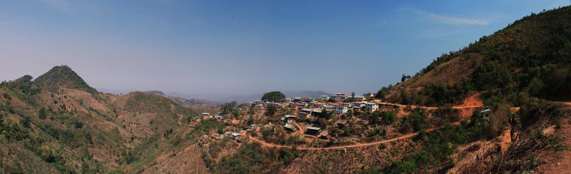
The mountains of Myanmar – with nothing but a hand sketched map and a name


Arriving in what was meant to be Kalaw at 3:30am but turned out to be Aungban I grabbed my things from the undercarriage of the bus and took a moment to think on the side of the road. Apparently there had been some miscommunication with the bus driver and we had already passed Kalaw. Unsure of where I was or how far Kalaw actually was all I knew I was somewhere between there and Schwenyuang, the junction to Inle Lake. In the darkness a moto-taxi driver approached me to ask where I was going. ‘Kalaw,’ I said. After a bit of a chit-chat I was able to decipher that Kalaw was only 15kms back the other way... about 20 minutes by motorbike. The chap to my right offered to drive me there for the outrageously inflated tourist-night-price of $5. After paying more than the locals for my bus ticket (pocket money for generals) from Yangon, I wasn’t in the mood for giving my money to people who didn’t deserve it. If I waited till light I would be able to get a pick-up (mini-truck with two metal benches down either side of the tray), shared with about 20 other locals, for about 500 kyats (about 50 cents). Moto-taxis are always more, and especially at the ungodly hour of the morning I had found myself in. So I offered the guy a very modest 1000 kyats.. I’d be lucky if he accepted even in the daytime. Because he felt sorry for me, the bus didn’t drop me off where it was meant to and I was alone, he graciously accepted my offer. I wisely donned my jacket in the crisp mountain air and we set off on our way.

By the time we arrived in Kalaw I was absolutely freezing. Shivering from head-to-toe my moto-driver stopped by a small fire lit on the side of the road by some locals where I could defrost in the pre-dawn darkness. I couldn’t be bothered getting a hotel room so I waited out until first light at a small Nepalese tea shop on the side of the road where I enjoyed (for the first time since visiting Nepal) real chai and freshly cooked samosas.

Indonesia Chapter 5: Rinjani, your mine.


The sunrise which started it all
 Rinjani. Your ass is grass.

Towering above the Bali sea at 3726 meters Rinjani is one monsterous volcano. The concluding statement in a guidebook states, ‘Finally, understand that people die every year on the mountain; it shouldn’t be approached lightly.’ A reason why I deliberated for so long on Gili Air about the weather conditions. After negotiating a very nice price with a trek operator and deciding that, surely, the weather would hold up I headed straight from the Gilis up the mountain.